
Snow Modelling is the science of understanding how snow forms, falls, settles, melts, and affects the world around it. It may sound like something only meteorologists or climate researchers talk about, but it touches daily life more than most people realize. When a winter storm is expected, when ski resorts plan their season, when cities prepare snowplows, or when water managers estimate spring runoff, snow predictions often begin with careful models.
Snow is not just frozen rain. It behaves differently depending on temperature, wind, humidity, elevation, sunlight, soil conditions, and even the shape of the land. A storm can drop light powder in one valley and heavy wet snow just a few miles away. That is why scientists use weather data, satellite images, ground sensors, computer simulations, and long-term climate records to predict what snow will do next.
At its heart, Snow Modelling helps answer three practical questions: how much snow will fall, how long it will stay, and how much water it will release when it melts.
What Is Snow Modelling?
Snow Modelling is the process of using scientific data and computer systems to estimate snowfall, snowpack, snow depth, snow melt, and related winter weather patterns.
Instead of looking only at what is happening outside right now, scientists combine many types of information. They study air temperature, moisture, wind speed, cloud formation, land elevation, solar radiation, soil temperature, and previous snow conditions.
A good model does not simply say, “It will snow.” It tries to estimate:
- Where snow is most likely to fall
- How much snow may accumulate
- Whether snow will be dry, wet, heavy, or icy
- How deep the snowpack may become
- When melting may begin
- How much water is stored in the snow
- Whether snowmelt may raise flood risk
This matters because snow is part of a much bigger system. According to the World Meteorological Organization, snow plays an important role in the climate system, the water cycle, and regional weather patterns. Accurate snow data is essential for forecasting and modelling changing snow conditions.
Why Snow Is Hard to Predict
Snowfall prediction is tricky because snow depends on very small changes in the atmosphere. A temperature difference of just a few degrees can turn expected snow into rain, sleet, freezing rain, or a messy mix.
This is one reason winter forecasts sometimes change quickly. A storm track shifting slightly north or south can completely alter snowfall totals for a city or mountain region.
Snow is also influenced by elevation. In mountainous areas, lower valleys may receive rain while higher slopes get heavy snowfall. Wind can move snow after it lands, creating deep drifts in one area and bare patches in another.
Scientists must also consider the type of snow. Light, fluffy snow contains less water. Heavy, wet snow contains much more water and can create problems for roads, roofs, power lines, and rivers.
This is where Snow Modelling becomes valuable. It gives forecasters a better way to connect atmosphere, land, water, and time.
The Main Data Scientists Use to Predict Snow
Snow prediction begins with observation. A model is only as good as the data it receives, so scientists collect information from many sources.
Weather Stations
Weather stations measure temperature, humidity, wind, pressure, precipitation, and snow depth. Some are located in cities, while others sit in remote mountains or open fields.
These stations provide real-time information that helps models understand current conditions. For snow forecasts, temperature and moisture are especially important.
Satellites
Satellites help scientists see snow across wide areas. They can track snow cover, brightness, surface temperature, and changes in snow extent over time.
NASA notes that Earth-observing satellites collect snow cover data that helps researchers study water cycles, ecosystems, agriculture, and climate processes.
Satellites are especially useful in remote regions where ground stations are limited. A mountain range, Arctic landscape, or large watershed may be difficult to measure from the ground, but satellite data can give scientists a broader view.
Radar and Weather Models
Weather radar helps detect precipitation in the atmosphere. It can show where a storm is moving and how intense it may be.
However, radar alone cannot always tell whether precipitation will reach the ground as snow, rain, or ice. That depends on the temperature profile from cloud level down to the surface.
Computer weather models fill in this gap by simulating atmospheric layers. They estimate whether falling precipitation will remain frozen or melt before reaching the ground.
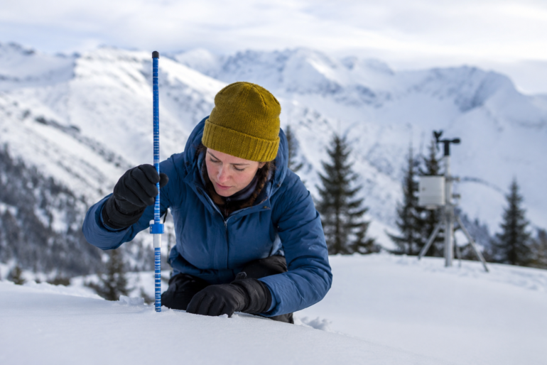
Snow Sensors and Field Measurements
In snow-heavy regions, scientists use snow pillows, snow courses, and manual measurements to understand what is happening on the ground.
A snow pillow is a sensor placed under the snowpack. As snow builds up, the pressure changes, allowing scientists to estimate how much water the snow contains.
Manual snow surveys are also important. Researchers may travel into the field to measure snow depth and density. These direct measurements help validate model results.
Understanding Snow Water Equivalent
One of the most important terms in Snow Modelling is snow water equivalent, often shortened to SWE.
Snow water equivalent means the amount of water contained in a snowpack. In simple terms, it answers this question: if all the snow melted at once, how deep would the water be?
The National Weather Service explains that snow water equivalent is the depth of water that would cover the ground if the snow cover were liquid. River forecasting models use this value, along with temperature and sunshine information, to estimate snowmelt entering river channels.
This number matters more than snow depth alone.
For example, 12 inches of light powder may contain much less water than 6 inches of wet, dense snow. To a skier, the first snow may feel better. To a flood forecaster, the second snow may be more concerning.
Why SWE Matters
Snow water equivalent helps with:
- River flood forecasting
- Reservoir planning
- Drinking water supply estimates
- Irrigation planning
- Hydropower production
- Drought monitoring
- Avalanche risk assessment
In regions where snowmelt feeds rivers and reservoirs, SWE can shape water decisions months in advance. The USDA Climate Hubs notes that snow is a key water source in the Northwest United States, and SWE helps water and resource managers plan water use.
How Snowfall Forecasting Works
Snowfall forecasting usually begins with large-scale weather prediction. Meteorologists study storm systems, jet streams, moisture flow, pressure patterns, and cold air masses.
Then the forecast becomes more local. Scientists look at surface temperatures, elevation, wind direction, and terrain.
A basic snow forecast may follow this chain:
- A storm system develops.
- The model estimates where moisture will travel.
- Temperature layers are analyzed.
- The model predicts whether precipitation will fall as snow.
- Snow-to-liquid ratios are estimated.
- Local terrain and wind effects are added.
- Forecast totals are adjusted with real-time observations.
Snow-to-liquid ratio is another key idea. A common rough estimate is 10 inches of snow for 1 inch of liquid water, but real storms vary widely. Cold, dry air may produce fluffy snow with higher ratios. Warmer storms may produce dense snow with lower ratios.
This is why two storms with the same liquid precipitation can create very different snowfall totals.
The Role of Temperature in Snow Modelling
Temperature is one of the biggest factors in snow prediction. But scientists do not only look at the temperature near the ground.
They study the vertical temperature profile of the atmosphere. This means they examine the temperature at different heights from the cloud to the surface.
If the entire layer is below freezing, snow is more likely. If a warm layer exists in the middle, snowflakes may partially melt and refreeze as sleet. If the surface is below freezing but rain falls from warmer air above, freezing rain may occur.
Small temperature changes create big forecast challenges.
For example, a city sitting near 32°F may receive heavy snow in one part of town and cold rain in another. Roads, bridges, and shaded areas may also freeze differently.
In Snow Modelling, temperature is not just a number. It is a moving pattern across height, time, and geography.
How Terrain Changes Snowfall
Mountains can dramatically change snowfall. When moist air rises over a mountain, it cools. Cooler air holds less moisture, so precipitation often increases on the windward side.
This process is called orographic lift. It is one reason mountain regions can receive much heavier snow than nearby lowlands.
On the other side of a mountain, air may descend and dry out. This creates a rain shadow, where snowfall may be lower.
Terrain also affects sunlight. A north-facing slope may hold snow longer because it receives less direct sun. A south-facing slope may melt faster.
Snow models must account for:
- Elevation
- Slope direction
- Valley shape
- Forest cover
- Wind exposure
- Sun angle
- Shaded areas
This is why mountain snow forecasts are often more complex than flatland forecasts.
Snowpack Modelling: More Than Fresh Snow
Fresh snowfall is only one part of the story. Once snow lands on the ground, it begins to change.
Snow crystals settle, compact, melt, refreeze, and bond with other layers. Wind can carve, move, or pack snow. Sunlight can warm the surface. Rain can add water to the snowpack.
Snowpack modelling studies these changes over time.
This is important because an old snowpack may behave very differently from new snow. Layers inside the snow can become weak or icy. In avalanche terrain, weak layers can be dangerous because they may collapse under weight.
For water managers, snowpack condition matters because it affects melt timing. A deep snowpack may not cause flooding if it melts slowly. A moderate snowpack can still create trouble if warm rain falls on top of it.
How Scientists Predict Snowmelt
Predicting snowmelt is one of the most useful applications of Snow Modelling.
Snowmelt depends on several energy sources:
- Air temperature
- Sunlight
- Wind
- Humidity
- Rainfall
- Ground heat
- Cloud cover
- Snow color and reflectivity
Clean, fresh snow reflects a lot of sunlight. Dirty or older snow absorbs more heat and melts faster. This reflectivity is called albedo.
NASA’s SnowEx program studies snow properties using remote sensing, including snow surface temperature and albedo, to better understand snowpack changes over hourly, seasonal, annual, and longer time scales.
In practical terms, snowmelt models help answer when rivers may rise, how much water may flow into reservoirs, and whether communities should prepare for flooding.
Snow Modelling and Flood Forecasting
Snow can quietly store water for weeks or months. When spring arrives, that stored water enters rivers and streams.
If melting happens gradually, it can support water supply. If melting happens too fast, it can raise flood risk.
Flood forecasters pay close attention to:
- Snow water equivalent
- Soil moisture
- River levels
- Rainfall forecast
- Temperature trends
- Ice jams
- Rate of warming
Rain-on-snow events can be especially risky. When warm rain falls on an existing snowpack, it can speed up melting while adding more water at the same time.
This can overwhelm rivers, especially if the soil is frozen or already saturated.
Snow Modelling gives emergency managers more time to prepare. It can help communities decide when to issue flood watches, manage reservoirs, clear drainage channels, and warn people in low-lying areas.
Snow Modelling and Climate Change
Snow is sensitive to climate change because it depends so strongly on temperature.
Warmer winters can mean less snowfall, more rain, earlier melting, and shorter snow seasons. In some regions, heavy snowstorms may still happen, but the long-term pattern of snowpack can shift.
The World Meteorological Organization has emphasized the importance of monitoring snow because changing snow dynamics affect weather, climate, and water resources.
NASA also highlights that snow cover data supports studies of climate processes, water cycles, agriculture, and ecosystems.
These changes matter for people. Communities that rely on mountain snowpack for drinking water, farming, hydropower, tourism, and ecosystems may face more uncertainty.
For example, if snow melts earlier in spring, water may flow downstream before farms and cities need it most in summer. That can increase pressure on reservoirs and groundwater supplies.
Real-World Uses of Snow Modelling
Snow prediction is not just a research topic. It supports decisions in many industries.
Road Safety and City Planning
Cities use snow forecasts to prepare snowplows, salt trucks, emergency crews, and public alerts.
A better forecast can reduce accidents, improve traffic planning, and help schools or businesses decide whether to close.
For road crews, timing matters. Treating roads before snow or ice forms can be more effective than reacting after conditions become dangerous.
Aviation
Airports rely on accurate winter weather forecasts. Snow, freezing rain, and low visibility can delay flights, affect runway safety, and require de-icing.
Snowfall intensity and timing are critical. A storm arriving during peak travel hours can cause major disruption.
Agriculture and Water Supply
In many regions, snowpack acts like a natural reservoir. It stores winter precipitation and releases water during spring and summer.
Farmers, irrigation districts, and water agencies use snowpack models to plan seasonal water use.
If the snowpack is low, drought planning may begin early. If snowpack is high, reservoir managers may need to create storage space before meltwater arrives.
Hydropower
Hydropower systems depend on water flow. Snowmelt predictions help operators estimate how much water may be available for electricity generation.
Good modelling supports better timing, efficiency, and risk management.
Ski Resorts and Winter Tourism
Ski resorts use snowfall and snowpack predictions to plan operations, staffing, snowmaking, grooming, and opening dates.
Tourism businesses also benefit from knowing whether a winter season may be strong, weak, early, or delayed.
Avalanche Forecasting
Avalanche specialists study snow layers, wind loading, temperature changes, and slope conditions.
Models cannot replace field expertise, but they help forecasters understand where dangerous snowpack conditions may develop.
Common Snow Modelling Methods
Scientists use different types of models depending on the goal.
Statistical Models
Statistical models use historical data to find patterns. For example, they may compare past snowpack, temperatures, precipitation, and streamflow to estimate future runoff.
These models can be useful when long records are available.
However, they may struggle when climate patterns change or when unusual weather events occur.
Physical Models
Physical models simulate snow processes based on energy, mass, and water movement.
They may calculate how snow accumulates, compresses, melts, refreezes, and releases water.
These models are powerful, but they need detailed data.
Remote Sensing Models
Remote sensing models use data from satellites, aircraft, drones, or other sensors.
They are helpful for large or hard-to-reach areas. They can monitor snow cover, surface properties, and changes over time.
NASA notes that remote sensing is especially useful for snowpack assessment and water resources applications.
Machine Learning Models
Machine learning is increasingly used in weather and climate research.
These models can detect patterns in large datasets, improve local forecasts, and combine information from multiple sources.
Still, machine learning models must be carefully tested. A model that performs well in one region may not work as well elsewhere.
Why Snow Forecasts Sometimes Get It Wrong
Even advanced models are not perfect. Snow is one of the hardest weather elements to predict because it sits at the boundary between atmosphere and land.
Forecast errors can happen because of:
- Slight shifts in storm track
- Unexpected temperature changes
- Terrain effects
- Poor data coverage in remote areas
- Rapidly changing wind patterns
- Mixed precipitation
- Local microclimates
- Uncertain snow-to-liquid ratios
A forecast may correctly predict precipitation but miss the exact snow amount. Another forecast may correctly predict snow in the region but place the heaviest band a few miles away from where it actually falls.
This does not mean the science failed. It means the atmosphere is complex, and models are constantly being improved.
A Simple Scenario: How a Snow Model Helps a Town Prepare
Imagine a small mountain town expecting a winter storm.
The first forecast shows 8 inches of snow. Local officials prepare snowplows and road salt.
Then new model data shows the storm pulling in more moisture. Temperatures are expected to stay colder than first predicted. The updated forecast now shows 14 inches, with strong winds near the mountain pass.
At the same time, snowpack data shows older snow already sitting on steep slopes. Avalanche teams become more alert. School officials prepare for possible closures. Utility crews get ready for power line issues.
The next morning, the town receives 13 inches.
The forecast was not just a number. It helped many people make better decisions before the storm arrived.
That is the real value of Snow Modelling. It turns complex weather data into practical action.
Actionable Tips for Reading Snow Forecasts Like a Pro
You do not need to be a scientist to understand winter forecasts better. A few simple habits can help.
Look Beyond the Snowfall Total
A forecast of 6 inches does not tell the whole story. Ask what kind of snow is expected.
Light powder may be easier to clear. Heavy wet snow can damage trees and power lines.
Check the Temperature Trend
The most important number is not always the current temperature. Look at how temperatures are expected to change during the storm.
If temperatures rise above freezing, snow may turn to rain or become icy later.
Watch for Wind
Wind can reduce visibility and create drifting snow. In open areas and mountain passes, wind may be as dangerous as snowfall itself.
Pay Attention to Timing
Two inches of snow during the night may cause fewer problems than two inches during rush hour.
Timing affects road safety, school schedules, and travel delays.
Understand Snow Water Equivalent
If a forecast mentions SWE or water content, take it seriously. It tells you how much water is stored in the snow, which matters for flooding and water supply.
Follow Local Sources
National forecasts are helpful, but local meteorologists often understand terrain, road patterns, and regional storm behavior better.
Frequently Asked Questions About Snow Modelling
Is Snow Modelling only used for weather forecasts?
No. It is used for weather forecasting, water management, flood planning, avalanche safety, climate research, agriculture, hydropower, transportation, and winter tourism.
What makes snow prediction different from rain prediction?
Snow depends heavily on temperature layers in the atmosphere. A small warm layer can change snow into sleet, freezing rain, or rain. Snow also changes after it reaches the ground, which adds another layer of complexity.
Why do snowfall forecasts change so often?
Winter storms can shift quickly. Small changes in temperature, moisture, wind, or storm track can lead to very different snowfall totals. Updated models use newer data, so forecasts are adjusted as conditions become clearer.
What is the most important snow measurement?
Snow depth is useful, but snow water equivalent is often more important for water supply and flood forecasting. It shows how much water is stored in the snowpack.
Can satellites measure snow accurately?
Satellites are very useful for tracking snow cover over large areas, especially remote regions. However, estimating snow depth and water content can still be difficult, so satellite data is often combined with ground measurements and computer models.
How Snow Modelling Is Improving
Snow science continues to advance. Better satellites, stronger computers, more detailed terrain maps, and improved sensors are making forecasts more accurate.
Researchers are also working to combine different data sources more effectively. Ground sensors provide local detail. Satellites provide broad coverage. Weather models provide atmospheric predictions. Machine learning can help connect patterns across huge datasets.
The future of Snow Modelling will likely be more precise, more local, and more useful for everyday decisions.
For example, instead of only forecasting snowfall for a whole city, models may increasingly help predict which neighborhoods, roads, or slopes face the greatest risk.
That kind of detail can save money, protect infrastructure, and improve public safety.
Conclusion
Snow Modelling is much more than predicting whether flakes will fall from the sky. It is a practical science that connects weather, water, climate, terrain, and human decisions.
It helps scientists estimate snowfall, track snowpack, predict snowmelt, manage water supplies, prepare for floods, and understand long-term winter weather patterns. From mountain communities to city roads, from farms to reservoirs, the information it provides can make a real difference.
The next time you see a winter forecast, remember that behind the number is a complex system of observations, sensors, satellites, physics, and experience. Snow may look quiet on the ground, but it tells a bigger story about weather, water, and climate.
As winter patterns continue to shift, Snow Modelling will become even more important for planning, safety, and smarter environmental decisions. It helps us understand not only today’s snowfall, but also the future of snow cover in a changing world. You can learn more about snow cover and its role in climate and seasonal landscapes.